Last night the Harbor Master walked the docks collecting payment and he told Barrie that the name of our boat “Chug” was a derogatory term for First Nations people. This came as shock and Barrie explained that we had no idea and certainly did not mean harm. Our boat was christened “Chug” by its first owner in 1987 and when we bought the boat, we thought the name fit. We chug-along at 6 or 7 knots and enjoy moving slowly through the water. We pay heed to tides and winds and plan our trip to use these resources to our advantage. The Urban Dictionary says the word Chug refers to a drunken First Nations person. This new knowledge doesn’t sit well with either of us and we wonder if after 30 years, we need to change the boat’s name.
 |
| In Zeballos you still need these! |
We
work our way south down Zeballos Channel with both wind and tide against
us. Still we are making almost seven
knots. We turn into Esperanza Channel
and soon pass a bucolic setting with several houses, a mission and a dock and a
fuel dock. A few hundred meters later
(we are in Canada), we pass the “village” of Ceepeecee. There is not much left here but the name –
which has an interesting history. The
Canadian Pacific Cannery was the driving force behind the development of this
area and when it came time to establish a Post Office, the town needed a name. A townsperson said it was CPC and the rest,
as they say, is history. This channel
connects Zeballos (named after the explorer Ceballos) with Tahsis. The guidebooks seem to indicate that Tahsis
is a larger town. We tie-up at the small
government dock on the outskirts of town.
It is still low tide and only one side of the dock is usable. There is a small boat already at the dock and
just enough room for us to squeeze in on the end. We walk the mile or so to the “city” center and
stop at both the grocery store and the hardware store. We purchase two small items at the grocery
store and part with $12 Canadian.
Ouch! We also buy two small items
at the hardware store and get change from $4.
Better! We contemplate have lunch
of the economy but really the only restaurant seems to be void of people and is
not attractive. We decide to walk back
to the boat and have lunch aboard.
 |
| Geting our exercise in Tahsis |
On
our walk back, we stop at the Marina.
The Marina is clearly open and seems to be set up to be party-central
but there are no boats here. It is now
the 23 of June and maybe the summer season hasn’t started yet. I do find a coffee shop and treat myself to a
latte. The walk from the marina to the
government dock takes us past acres of fenced-off old blacktop pavement with
trees and weeds. We learn that this area
was a huge lumber mill that processed hemlock.
It has long been out of business.
The
weather forecast for this area is not good for next week. Winds are expected rise to 25-35 knots by
Tuesday and stay that way for a few days.
But there is still a window of good weather that is expected to last
through Sunday morning. We decide that
we need to use this weather window to get around Estevan Point. This is the piece of land that separates
Nootka Sound from Clayoquot Sound and the winds often howl here.
We
have passed the halfway point on our journey down the west coast of Vancouver
Island. We are now nearer to Port Townsend
than we are to Cape Scott and we are now listening to the Environment Canada
weather report for “West Coast Vancouver Island South”. While
there is still plenty of nature to enjoy, we expect to see more boats and more
people as we head south. We also expect
that we will be able to pick up internet service more easily and perhaps my
blog updates will be more timely. I am
reluctant to leave this wilderness behind.
 |
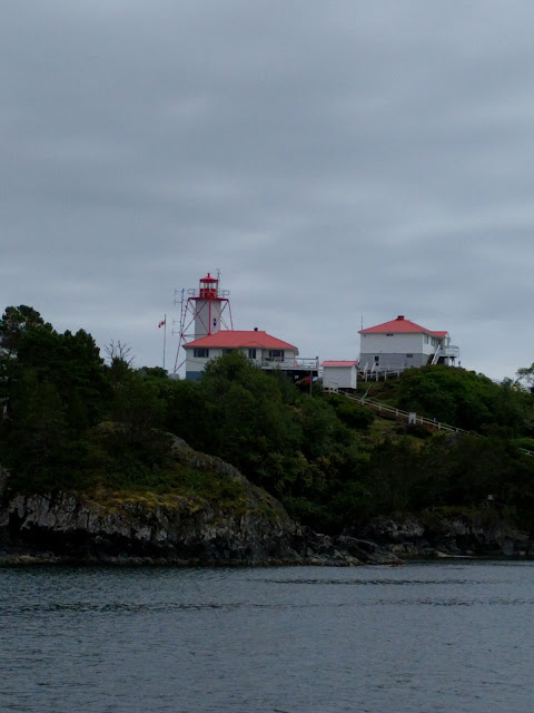
| The Light at Friendly Cove |
No comments:
Post a Comment